Wednesday, November 10, 2010

Cranes leave the nest but find new dad

By David Horst  sandhill7@gmail.com

FREMONT, Wis -- For a short time on a recent Sunday, I felt a little like Father Crane.
It was a natural reaction to the following situation.
Chuck leads crane #302

I am running through a cut hay field. My arms are … well … flapping.
Running behind me are four sandhill cranes. I begin to separate from them and one or two of the cranes open their 5-foot wingspan and float up and over my head, landing slightly in front and on either side of me.
It sounds like I’m describing some strange nature lover’s dream – and it would be a good one – but this was reality. As pleasant a reality as it might have been, it was not what we wanted to have happen.
We were on a dead-end farm road south of Fremont to release these young cranes back into the wild so they could link up with their peers before the migration south. They had been in the care of The Feather Rehabilitation Center near New London, which is to say they were in the care of Pat Fisher. She is a one-woman nonprofit operation.
The cranes had come to her from around the state, not injured but kicked out of their nests, probably by their siblings.
Female sandhill cranes typically lay two eggs, though normally only one of the young makes it to maturity. It may be predation of the egg or young bird by skunks, raccoons, foxes or coyotes. Or it may be the smaller of the two coming up short in survival of the fittest.
Nature may be beautiful, but she often is not kind.

Sunday, September 12, 2010

Section 7B: Lutz Park to Sunset Point Park

Launch:  Lutz Park, Appleton
Takeout: Sunset Point Park
Distance: 6.4 miles


Google map
We had planned a dramatic finish to the cannon fire of the tall ships in Green Bay. Instead, the end of Fox River Heritage Paddle 2010 is greeted by the oompah of a polka band in Kimberly, but the final group paddle couldn’t have been better.

The first really good forecast of the series of 12 day trips on the Fox River helps to draw 116 participants last Sunday for the paddle from Lutz Park in Appleton to Kimberly’s Sunset Point Park, the site of the village’s centennial celebration.

Sun and upper 70s accompany the paddlers on the trip through the living history of the four hand-operated Appleton locks, now restored to their 19th century glory.

As a bonus, we get a demonstration of another historic bit of technology.

The residual of the high water levels that caused the delay of this and two other segments of the journey reduced the clearance under the railroad bridge downstream of Lawe Street enough to prevent the 28-foot voyageur canoe from passing under.

The center-pivot bridge is designed to swing out of the way of boat traffic, and would have, if not for the whistle of the approaching train. So we sit waiting, part of the group having already slipped under, heads pressed to decks, and others still waiting.

When the engineer passes the rare sight of a river full of boats, paddlers wave and he waves back. The bridge swings open and on we go.

There is some drama as we approach lock four. A kayaker drifts too close to the water inlet to the hydroelectric generator there. The current sweeps him in and knocks him from his boat. The grate over the inlet stops him from going any farther, but the force of the water pins him there.

The call of “man down” brings the Appleton Fire Department and Outagamie County Sheriff’s Department rescue boats and paddle organizers immediately. Three men pull him free. Uninjured and undeterred, he gets back into his kayak on the other side of the lock and finishes the trip.

Saturday, September 4, 2010

Segment 7A: Park-to-Park Paddle


Launch: Shattuck Park,  Neenah
Takeout: Lutz Park, Appleton
Distance: 8.5 miles

There’s a t-shirt they sell to kayakers and sailors at the park headquarters for the Apostle Islands in Bayfield. It says: “The lake is in charge.
 

Mark Hoffman photo
That was the story on Little Lake Butte des Morts for the ninth annual Park-to-Park Paddle. The 30 mph wind gusts sweeping across the lake convince a lot of people that the 4-mile route from our launch at Shattuck Park in downtown Neenah to the early out at Fritse Park in the Town of Menasha is good enough.

Others, determined to complete the full 8.5 miles to Appleton’s Lutz Park, scatter based on their approach to navigation. Some B-line down river to take the shortest path between two windy points. Others head straight into the west wind to get to the lee shore, where land and buildings will block the gusts.

This less pleasant section of the Park-to-Park comes right after the fun part – stuffing more than 100 kayaks and canoes carrying 150-plus people into the Menasha Lock and smiling for photos.
Google map

Our route from Shattuck takes us out the Neenah channel, into Lake Winnebago and around the point of Doty Island and into the Fox – and into the teeth of the wind.

The trip through downtown Menasha collapses the eras. Paper mills, a smattering of surviving retail and riverside retirement condos stand side by side. Then it’s through the lock and out into Little Lake Butte des Morts. Don’t be deceived by the “little” in its name. It can harness the wind with the biggest of them.

Directing the arriving traffic that morning, I could see trouble coming. A lot of the vehicles were packing small river boats. They’re made for going with the current and bouncing off rocks, not for tracking through a crosswind. The result was a lot of tuckered paddlers.

A few of them get wet. I heard stories of at least five boats capsizing.

Thanks to the certified instructors from Northeast Wisconsin Paddlers and patrol boats from the Outagamie County Sheriff’s Department and Appleton Fire Department, everyone gets help quickly and no one is injured.

Despite all of the misfortunes I describe here, this was a good time, certainly for me and I think for most.

You can find out why from another t-shirt: “A bad day on the water is better than a good day at work.”

Sunday, August 15, 2010

Segment 9: De Pere to Green Bay

Launch: Bomier Boat Landing, De Pere
Takeout: Green Bay Metro Marina
Distance: 8 miles
See larger map

Google map
Tall ships bring out lots of low boats on what was to be the last segment of the Fox River Heritage Paddle 2010 kayak and canoe trip.

Clear skies and warm temperatures don’t hurt either.

We expected that the reproductions of old wooden sailing ships in Green Bay for the Baylake Bank Tall Ships Festival would make for a good turnout for the victorious conclusion of the series. But because heavy July rains and the resulting high water caused the rescheduling of three earlier segments, the end of the route was not the last of the journey.

It seems like there are boats everywhere at the Bomier Boat Launch in De Pere. A roll call in the De Pere lock tallies 98 paddlers in 74 boats – a record for the lock tender.

The lock is also the setting for a freak mishap. One of the kayakers drifts back against a recessed steel ladder in the interior of the lock. When the tender opens the valves to draw down the lock, the front of the kayak lowers with the water level but the back end – hooked onto the ladder by its rudder – stays up high.


The boat is approaching a 45-degree angle when Bob Kriese of Waupaca, one of the more skilled paddlers in the group, jumps into the water, swims to the ladder and frees rudder from wrung. The boat drops with a splash, but its calm occupant stays upright.

We are quite a sight, as boats of every color spread out down the Fox. As always, their occupants range from teens to 70s. We have in common a love of open water and the camaraderie of those who share it.

As we approach downtown Green Bay, spectators on the bridges turn from the tall ships to the curiosity of the low boats. Kriese and Jake Stachovak, the Portage-to-Portage paddler, entertain them with a show of rolling. Jake stands up in his boat and waves to the crowd.

The tall ships, 12 in all, give us another history lesson. We keep our distance, as the U.S. Coast Guard has required, but paddle slowly through gawking. A blast of cannon fire makes us jump in our boats – not enforcement by the Coast Guard but a show for the people on shore.

We leave the colonial era for the modern powerboat haven at the Green Bay Metro Marina, back on shore and back to the present.    

Segment 8: Wrightstown to De Pere


Launch: Wrightstown Boat Landing
Takeout: Bomier Boat Launch, De Pere
Distance: 11.4 miles
Google map
See larger map

This segment of the Fox River is much further away from the Upper Fox than even the nearly 200 miles that separate them.

The mansions on this stretch of river are a sight to behold. The boathouses would look highfalutin next to homes upriver in the likes of Endeavor or Montello. Sprawling, manicured, limestone-terraced landscaping here costs more than entire homes up there. Though you wonder whether their owners enjoy the river any more.

Our trip starts at the Wrightstown boat landing with a couple of guests. A steamer launch right off the screen from African Queen greets us at the landing, but its travel plan takes it upstream.


Our other guest is Jake Stachovak, the Wausau man whose “Portage to Portage” kayak journey around the eastern United States has made him a celebrity in the silent sport. He paddles along with us – unusual for him – with the current. He is enjoying the company before resuming his one-man, 5,000-plus-mile circular trip from Portage, down the Wisconsin and Mississippi rivers, into the Gulf, up the Atlantic seaboard, through the canals of New York State, through the Great Lakes and, finally, up the Fox River back toward Portage.

Jake tells of the incredible outpouring of support he’s received on his quest to show people that we’re all linked together and how paddle sports allow you to find adventure in your own town. He encounters kindness again during the Wrightstown-to-De Pere segment.

At our planned lunch stop at the Little Rapids Lock, the shore proved too rocky and steep, so we locked on through and headed for Lost Dauphin Park just downstream, only to find equally unwelcoming conditions. Down a few houses, a homeowner named Tom was weed-whacking his yard.

“How’d you like 37 guests for lunch?” I asked him. After hearing what we were up to, Tom invited us to lunch on his lawn. He and daughter Kate got a kick out of the voyageur and talking with Jake.

Well fed and rested, we climb back into our boats and paddle on to the upscale city of De Pere and the very accommodating Bomier Boat Launch, which is tucked into a neighborhood along the Fox River Trail just south of the downtown bridge.

Segment 9 map


Sunday, July 18, 2010

Segment 6: Omro to Terrell Island

Launch: Miller Park, Omro
Far point: Enter Terrell Island area via fish barrier
Takeout: Return to Yost Road landing
Distance: 6.5 miles


Raindrops beat fiercely on the truck windshield and bright bolts of lightning split the sky as we shuttled our vehicles for the Fox River Heritage Paddle 2010 segment from Omro to Terrell Island in Lake Butte des Morts.

Despite the prediction of all-day scattered thunderstorms, 45 kayak and canoe paddlers turn out at Fred C. Miller Park in Omro for a day of fun on the water. But it looks like one of the persistently bad forecasts that have dogged our weekend paddles all summer is actually going to prove to be correct. We delay the launch for about 45 minutes, but sunburn replaces lightning as the trip hazard. There are happy faces behind the paddles when we take off from Omro, led as always by the 28-foot voyageur canoe.

We definitely have entered the recreational section of the Fox River. We have to make way for a pontoon boat or bass slayer more frequently. Still, herons, egrets, an eagle and osprey are our companions.

Downstream of Omro, the Fox gradually opens up a marshy mouth into Lake Butte des Morts. This is the convergence of the Fox and the Wolf rivers. Once a barely passable bog of reeds and wild rice, artificially high water levels and boat traffic have opened up the shallow lake.

Terrell Island is an experiment by the Department of Natural Resources in turning back the clock for a corner of the lake by enclosing the area with a two-mile-long rock breakwater. It is intended to block out the boat wakes and turbid water of the lake to allow native vegetation to return, followed by native fish and mammals. We circle around its full length and land at the Butte des Morts Conservation Club headquarters.

The Terrell’s Island experiment has worked – too well in the case of one species, according to DNR biologist Art Techlow III, who gives the paddlers a natural history lesson. American white pelicans have returned in force. The experiment has also brought in common terns, egrets and various waterfowl. The DNR counted 13 nesting pelican pairs within the impoundment in 2005. By 2006, the number rose to 44, then 420 in 2007, 695 in 2008, 1,101 in 2009 and 1,068 overwhelming the little islands this spring.

Pelican guano has denuded the islands. That’s one of the unexpected consequences of experiments with nature on this scale, Techlow says. The DNR plans to shave down the islands to promote semi-aquatic vegetation and discourage pelicans.

After Techlow’s presentation, 10 paddlers pile into the voyageur and start paddling east. Not far out, they raise the big boat’s sail and let the wind push them all the way across Lake Butte des Morts. What a sight as this historic replica of Marquette and Joliet’s time sails under U.S. 41, painting a contrast between the journey and just getting there.

Saturday, June 26, 2010

Segment 5A & 5B: White River Dam to Omro

Segment 5A: White River Dam to Berlin
Launch: White River Lock, Lock Rd.
Takeout: Riverside Park boat ramp, Berlin
Distance: 13 miles

Segment 5B: Berlin to Omro
Launch: Riverside Park boat ramp, Berlin
Takeout: Miller Park boat ramp, Omro
Distance: 13.7 miles


They said it would be the most beautiful section, and the Fox River does not disappoint.

Here it’s less farm field and wetland and more wooded wonderland.

I’ve been looking at this weekend with some apprehension since the planning for Fox River Heritage Paddle 2010 started.

On a Saturday and Sunday we are covering 27 miles of river. That’s eminently doable, but don’t get between me and the Advil bottle come Sunday night.

Sunday, June 13, 2010

Segments 4A & 4B: Marquette to White River Dam

Segment 4A: Marquette to Princeton
Launch: Lyons St. Landing, Puckaway Lake
Takeout: Jefferson St. boat landing, Princeton
Distance: 15.7 miles
Looking out over Puckaway Lake
Google map

We are paddling our first double-header. We follow a long, twisting 16 miles from Marquette to Princeton on Saturday with a quick six miles from there to the White River Lock on Sunday.

I say lock rather than dam because the White River Dam has been removed. Unlike the lock system on the lower Fox, the upper Fox has no locks still in operation. We encounter the Princeton Dam, which actually lies several miles upstream of Princeton. It requires you to exit river left and portage through what is a heavily used park for fishing.

By this stretch of the Fox, recreation has taken a firm hold, though there is still plenty of agriculture along its banks. The structures here are more cottages than fishing shanties and lines stretching out from fishing boats are more frequent obstacles.

At one point approaching Princeton, we come upon a fisherman up on his tall pier struggling to dial his cell phone while keeping a grip on his doubled-over rod. He is attempting to call his son in the house to come down and net the lunker on his line.

Mark, one of our kayakers, comes to his aid, grabbing the landing net and hauling in a 
27-inch, 8-pound channel catfish for this total stranger. Really, there are no strangers on the river. People in lawn chairs yell to the 16-passenger voyageur canoe that leads us: ‘Hey, the guy in the back isn’t paddling.’”

“Un, deux, trios,” the voyageur in the back calls out, and all paddles rise in salute to the new friends on shore.

Upon landing at the quite nice boat landing and campground in Princeton, we are greeted by Princeton Mayor Bob Mosolf and Chamber of Commerce President Ron Calbaum. Their visit suggests communities along the Fox are seeing the potential of the Fox River water trail that our group is advocating. 

Segment 4B: Princeton to White River Dam
Launch: Jefferson St. Landing, Princeton
Takeout: White River Lock, Lock Rd.
Distance: 6 miles

Sunday’s segment downstream from Princeton brings a noticeably swifter current and a different mood.

I don’t know if it was the easier paddling or the aftereffects of the previous day’s distance, but this paddle is downright laid back. The 44 participants stay grouped up more and conversation runs rampant.

A highlight comes about halfway through this leg at a site commemorating the most famous travelers on the Fox – Fr. Marquette and Louis Joliet. A large cross marks the spot where Marquette blessed a series of springs that bubble up from the ground year-round. The spot was already sacred to the Native Americans when members of the Mascoutin, Miami, Kickapoo and Fox tribes turned out in 1673 to meet the famous blackrobe.

Segment 4A & 4B maps


Saturday, May 29, 2010

Segment 3: Montello to Puckaway Lake

Launch: Rendezvous Outfitters, Hwy. 22, Montello
Takeout: Good Old Days Resort, CTH C, north shore of Puckaway Lake
Distance: 11 miles
See larger map

Google map
The day is glorious as we set out on the 11 miles from Montello to Puckaway Lake.

This stretch of river still carves its way through wetlands, including the Grand Marsh. But it’s beginning to take on a recreational flavor. There are a few resorts. Powerboats become more numerous, most piloted by fishermen.

Our crew is a similar mix of kayaks and canoes, one with two preschoolers tucked between mom and dad. Doug, the standup paddler, completes the hat trick. Marshal, one of the more senior paddlers, smiles wider with each mile.

Marshal
A couple in short river boats someone dubs “plastic milk jugs” is learning why investing a little more in boats can be a better bargain. With no keel to speak of, they’re having trouble tracking straight. By the open water of Lake Puckaway, she’s losing steam in a big way.

We make a scheduled short stop at River’s Bend Resort, where we are well received as people drop some change on sodas. Besides the fun, the point of our “Journey of Rediscovery” is to demonstrate the benefits that would come to communities and their businesses with a designated river trail and National Heritage Area status for the Fox and Wisconsin Rivers.

The campground where we’re planning our lunch stop, hasn’t gotten the message. The owner asks us to leave. His campground is full and he doesn’t want us to do the same to his holding tank. You question the business decision of sending away 50 potential customers, and sending them away mad. The sodas and ice cream he would have sold would go a long way toward paying for a visit from the honeywagon.

So we pack up quickly and cover the final half-hour to Good Old Days Resort, whose owners were good enough to let us park there and are happy to have us raising a glass to them, and another good day on the river.

Segment 3 map


Saturday, May 15, 2010

Segment 2: CTH O to Packwaukee

Dirty Kettle
Google map

Launch: Landing at CTH O bridge
Takeout: CTH D landing, Packwaukee
Distance: 12.5 miles
See larger map

We reassemble at County O three weeks later to paddle the 12.8 miles to Packwaukee and Buffalo Lake. Our number has dipped to 40, still more than we anticipated at our winter planning meetings.

In this stretch, marshes line the banks. The predominant residents are cranes and great blue herons.

Shortly after we launch, a pair of bald eagles fly over the river, locking their talons in what appears to be playfulness.

The marshes south of Endeavor produced wiregrass, which was harvested throughout the mid-20th century to make rugs. Parts of the wetlands were drained to create muck farms that today grow a substantial crop of mint and Christmas trees.

This paddle is followed by a drum ceremony by re-enactor “Dirty Kettle.” We bless our instruments with tobacco, give thanks to the earth and pound out ancient rhythms.

Segment 2 map


Saturday, April 24, 2010

Segment 1: Portage to CTH O

What follows are re-edited versions of columns by freelance nature writer David Horst that originally appeared in The Post-Crescent – the daily newspaper in Appleton, Wis. – during the spring and summer of 2010.

The Journey begins
Three paddle trips, three different faces of the Upper Fox River.
I’ve been involved with a group that planned a series of paddle trips covering most of the Fox, collectively called Fox River Heritage Paddle 2010. After three of the 12 segments, I can tell you, it’s not the Fox River we’re used to up in the Fox Cities.


Launch: Indian Agency House, Portage
Takeout: Landing at CTH O bridge
Distance: 10.7 miles
See larger map

Google map
For the first leg of our journey, we are to depart from Portage, the connecting point – almost – for the Fox and Wisconsin rivers. Forty-seven paddlers turn out to journey the 10.7 miles to the landing at Marquette County Highway O. 

Traveling from Hortonville, rain pelts the windshield of my truck. I’m convinced the forecast for storms and lightening will prove correct and I’m driving an hour and a half for nothing.

But the rains stop in advance of the launch and we see no more than an intermittent drizzle.

The paddlers – couples and older guys and strapping youngsters – unload canoes of Fiberglas and aluminum, plastic kayaks, skin kayaks, wooden kayaks and a stand-up “Yak.” They fill the 16-seat voyageur canoe that leads us throughout these 120 miles of rediscovery.

Up here (up river, though geographically to the south) the Fox River is not all industry and houses that make the Fox Cities tax assessors so happy. In this section, the Fox is a country stream, lined with farm fields and fishing shacks and rarely running more than a couple of feet deep. Crane music accompanies us much of the way.
Mark Hoffman photo
Some among us appoint themselves to trash detail, relieving the river of various bottles and buckets, a duck decoy and a television set, which a kayaker with a flair for the ridiculous bungies to the front of his boat.
At Governor’s Bend Park we face the entirety of the Fox River’s rapids – a little chute that wouldn’t warrant a rating but delivers a little rush of fun. While the lower Fox drops nearly the height of Niagara Falls from Lake Winnebago to Green Bay, its whitewater was harnessed by a system of locks and dams more than a century ago.
We pass under the County O bridge and beach on the muddy bank. From there we get our first presentation on the history that flows with the river – a reading of pioneering environmentalist John Muir’s boyhood remembrances at John Muir Park.

Segment 1 map


Friday, April 23, 2010

Intro: A Journey of Rediscovery


In the spring and summer of 2010, a group of advocates for public access to the Fox River organized a series of kayak and canoe paddling day trips intended to show people the beauty and diverse landscape of the Upper and Lower Fox River – a “Journey of Rediscovery” of the Fox.

Stretching 200 miles through central and northeast Wisconsin from Portage to Green Bay, the Fox flows south to north through wetlands and agricultural fields, past rural retreats and million-dollar homes, through historic villages and industrial cities. To make the paddles as accessible as possible for paddlers of all ages and skill levels, the organizers excluded areas of open water and tough portages. The result was 12 segments over nine weekends covering 120 miles of the Fox River.

People responded. An average of 63 paddlers participated per event with 424 different people taking part in at least one segment and three people completing all 12.

Many of the paddles were followed by presentations on local culture or history. One such program early on featured Ottawa medicine woman Jackie Red-Woman. She told of the power of her carving of a turtle. Placed upside-down, she said, the turtle would divert bad weather around us. Despite forecasts of rain or thundershowers for nearly every segment, none was canceled by weather. We wish you the protection of the turtle as you pursue your own Journey of Rediscovery on the Fox.

Saturday, April 17, 2010

Sandhills mix it up for annual crane count

By David Horst  sandhill7@gmail.com

I talk to people on occasion – regular readers – who say they would like to come along on one of my outdoor “adventures.”

I like to think I take people along in writing about these opportunities to view nature that come my way, but there’s nothing like experiencing it for yourself. The experience does come with a cost.
For Dick Gosse, the cost was getting up early enough to be in a farm field outside of Hortonville at 5:30 a.m. last Saturday (April 17, 2010).

Gosse is an Outagamie County supervisor, a former Appleton alderman and a very recently retired dentist. More relevant to me, he and his wife, Karen, were the lead donors for the Environmental Stewardship Fund within the Community Foundation for the Fox Valley Region, which I have the pleasure of staffing as part of my day job.

Dick and Karen are devoted environmentalists, from the solar panels on their home to their advocacy for recreation trails.

In short, Dick is the kind of guy you know would enjoy a good sunrise crane show.

Thursday, April 15, 2010

Sandhills mix it up for annual crane count


I talk to people on occasion – regular readers – who say they would like to come along on one of my outdoor “adventures.”
I like to think I take people along in writing about these opportunities to view nature that come my way, but there’s nothing like experiencing it for yourself. The experience does come with a cost.
For Dick Gosse, the cost was getting up early enough to be in a farm field outside of Hortonville at 5:30 a.m. last Saturday (April 17).
Gosse is an Outagamie County supervisor, a former Appleton alderman and a very recently retired dentist. More relevant to me, he and his wife, Karen, were the lead donors for the Environmental Stewardship Fund within the Community Foundation for the Fox Valley Region, which I have the pleasure of staffing as part of my day job.
Dick and Karen are devoted environmentalists, from the solar panels on their home to their advocacy for recreation trails.
In short, Dick is the kind of guy you know would enjoy a good sunrise crane show.
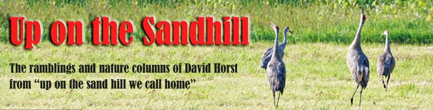
We set up behind an old barn near my place, overlooking the field where I have been counting cranes for a number of years. The usual routine is (1) I sip some steaming hot tea while listening to the crane music that marks their rousing in the swamp beyond the woods; (2) cranes emerge in ones or twos or threes and settle in the field; (3) the steady arrival of cranes has me swiveling the spotting scope in wide, sweeping circles to keep track of the arrivals.
We definitely had No. 1. There was a little of No. 2. But No. 3 never really happened.
I can say with great confidence that the explanation is not that the sandhill crane population is in decline. You see them everywhere – even in the remnant farm fields in and around Appleton.
There was a pretty good wind out of the northwest Saturday, and my thought is that kept the cranes in the woods. Another theory bandied around the check-in at Mosquito Hill Nature Center outside New London was that the early spring has the cranes sitting on nests early.
Whatever the cause, the cranes seemed to be on the move that morning. The usual hot spots ran cold.
“The numbers are all over the board,” Jess Miller, a naturalist at Mosquito Hill and the count coordinator for Outagamie County, said. “The cranes seem to have dispersed more into the fields.”
At her spot at the nature center, Miller counted less than half the normal crane visitors. Across the Wolf River, the number was higher than usual.
A good share of our count of nine birds came while they were in the air. We never has more than two on the ground at once, which means we never saw the best part of the crane show.
What we did see was a dozen deer and a flock of 20 turkeys, including two males with their tails spread in full display – like one of those Thanksgiving turkey candles, only with no discernable wick.
Dick had no complaints. He was content to watch turkeys, ponder the history of the rusting farm equipment in the old barn and commiserate with me about the State 15 bypass that will – when, we still don’t know – turn the crane habitat we were monitoring into four lanes of fast-moving traffic.
We build too many highways. We take too much farmland. We don’t treasure history enough. Those were the legislator’s pronouncements for the morning, and his faith in his ability to do something about it will never be shaken.
Next on Dick’s agenda was a grandchild’s birthday party. That’s a pretty blessed Saturday.